GIS Alumnus Soars in New Career
Selkirk College Provides the Perfect Launch Pad
Flying a state-of-the-art unmanned aerial vehicle (UAV) high above rugged rural terrain to collect survey data is a part of Selkirk College alumnus Alexandre Landry’s profession that will never grow old.
A geospatial analyst for Nelson’s Harrier Aerial Surveys, Landry is part of a team that provides high-precision surveying, geographic information system (GIS) data and remote sensing services to a diverse range of clients across the province. The majority of the data collected and analyzed by Landry is gathered using UAVs, more commonly known as drones.
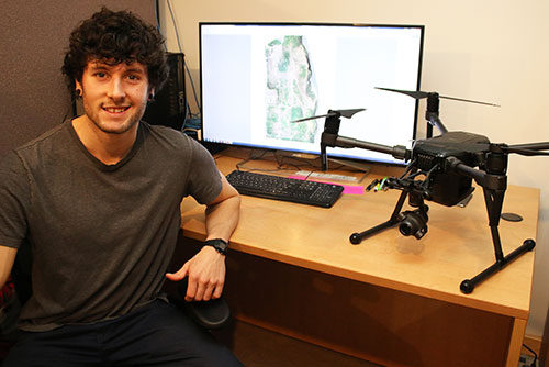
With time spent in the field and at the office, Selkirk College alumnus Alexandre Landry works in an exciting career at Nelson’s Harrier Aerial Surveys. Landry graduated from Selkirk College in 2017 with a Bachelor’s Degree in GIS.
“The job is not in any way mundane, there is always a new challenge,” says the 26-year-old who works out of an office in downtown Nelson when he is not in the field. “You have to stay up to date with new technology, new software and all kinds of cool new functionality that opens up possibilities on what seems like a monthly basis.”
Harrier Aerial Surveys was co-founded by veteran professional survey engineer Robert Simmerling and operations manager Peter Lecouffe, also a Selkirk College alumnus. The company specializes in aerial imagery, terrain modeling, mapping/GIS and inspections.
Read the entire story at selkirk.ca.